The maps (click on "Maps" in the left banner) were very kindly given to us by Simon of the Great Trees in the Clyst Valley Project. I hope you will find them of interest.
ASHCLYST FOREST
Guided walk on 12th (and repeated on 26th) September 2018
Gosh, I wouldn’t want to be alone and lost in Ashclyst Forest. It is so big and so silent (apart from the bird song) that I don’t think I’d ever find my way out! But we were all right; we numbered 20. Our superb guide took us round following the ‘Red Route’ so I suppose we couldn’t really get lost. It takes an hour if you get a move on but two hours if you wander and stop and look at things. We stopped and looked. Our guide, Jon, was an absolute font of knowledge, an archaeologist and a tree man. What better combination for a history walk round Ashclyst Forest ?
At the start Jon explained the known history of the area. Forests were marked in the Domesday Book but these records were produced for accounting purposes rather than for 21st century historians. It is difficult now to ascertain from the book the exact locations of those forests. But there were many in this area at that time.
Ashclyst Forest, however, is not that old. It was created by the Acland family only a couple of hundred years ago and for two reasons. One was the hunting that was possible – considered a great sport – and the other was simply money. They could use, or sell, the timber from felled trees and in fact a tree nursery was created which made a great profit from selling the seedlings (there is a record of 15,000 Scots firs being sold to one person!). By the 1840s the forest had increased to 200 acres - from 190 in 1808. It would not exist today if it was not actively managed – and that management is based on sound commercial practices.
Jon pointed out that we can see the remains of many hedge banks, some long and many so short that parts have obviously been broken up. Some of these were definitely created in the 18th century while the forest was being designed, but some are probably medieval, created to define grazing areas in those long-ago times. At the hill tops, though, where the land was not suitable for a farm, the space was available for grazing for all.
It is difficult to age a hedge bank without digging it up in search of ancient shards – not a sensible proposition. Trees grow in the hedge banks, though, and their age can be a clue to the age of the hedge bank. Unfortunately, however, the precise age of a tree can only be learnt by chopping them down and counting the rings – again not a sensible proposition. The development of a tree is accelerated or slowed down, by weather in particular, but other facts also affect it, so an educated guess may well prove to be surprisingly inaccurate.
We walked through a glade (right) which had been specifically designed to encourage butterflies and many different varieties have been identified there. The trees are prevented from encroaching on this land, which is devoted to growing butterfly-friendly vegetation.
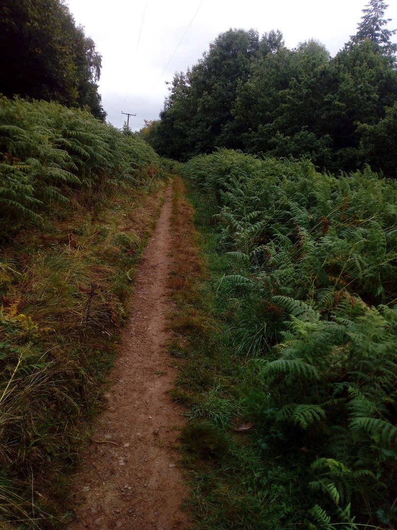
Further on, our path became ridged, each ridge a measured distance apart. The only reasonable explanation for these is that the area was strip farmed in medieval times and these ridges defined each peasant’s strip.
Jon pointed out oak, hazel, beech and ash on our meanderings and the joy is that they are not in separated areas but all mixed together. This makes it a wonderful habitat for a rich variety of wildlife. The concentration in Ashclyst has always been on native trees, but some interlopers have crept in! Jon identified a Western Great Cedar brought to the Clyst by the famous William Lobb who also brought some Wellingtonia. Some are in the forest - they tower above the other trees.
We paused on a little bridge over what appeared to be a dried-up stream. But no, it wasn’t a stream but a ‘Hollow Way’ – a path down the hill with hedge banks on both sides. You can tell the difference between the two because streams meander whereas a hollow way is usually straight (built by humans) and leads to somewhere – a road or a farm. Cattle grazing in the open upper areas of hill tops could be driven into the hollow way and the hedge banks would ensure that they proceeded down to their destination without wandering off.
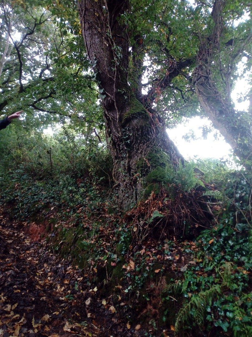
Many trees were so large, straight and slim in the middle of the forest but gnarled and all over the place near the edges! These large trees were called maidens. Jon pointed out (left) an old pollarded tree (growing out of a hedge bank!). Evidently the custom was carefully to protect trees from cattle while allowing them to grow to about six feet, then chop their tops off. Each tree would then sprout a number of trunks and as these grew they would be out of reach of cattle who would not therefore be able to chew off all the young leaves and thus destroy them. There were some splendid oak trees – the saying goes that an oak tree takes 300 years to grow to full height, has 300 years in its prime and then takes 300 to deteriorate, all along providing a wonderful habitat for wild life.
All trees belonged to the landowner and there were strict penalties for anyone else destroying them or even lopping off branches. However, pollarded and discarded branches and such were left for the poor farmers to help themselves and these provided much needed timber for rebuilding homes and for fuel.
We came to a substantial flat walkway some 8ft wide with the usual hedge banks both sides. It was very straight and led nowhere. There is much conjecture as to its original purpose. On a 19th century map it is called ‘Forest Ride’ and certainly it is wide enough for a coach and horses, so perhaps the ladies liked to take a little open carriage trip along it, but it may only have been used for a trailer carrying cut timber.
 Copyright David Snell
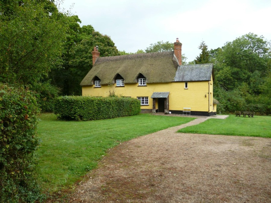
But it did lead us to a charming thatched cottage (now divided into two separate homes) which was probably one of several game-keepers’ cottages. After all, policing – or at least supervising – of the forest would have been very important to keep out thieves and vagabonds. The cottage had kennels, probably to accommodate hunting dogs. At Cadhay, we were told, there was another similar cottage, now a scout hut. But all the others have gone.
Suddenly we found ourselves back by our cars, my sense of direction having failed me completely much earlier on the walk. Jon explained to us the work their team were doing to identify every tree – a mammoth task – and told us of their great disappointment when searching for a King and Queen Oak listed on old maps. Diligent searches revealed nothing !
We all thanked Jon most heartily for a fascinating and interesting morning. The walk elicited such comments as:
“Enjoyed the walk/talk - learnt so much in 2 hours”
“What an unusual event it was. I'm a city girl so certainly learned a lot yesterday. Thanks for your usual excellent organisation”
“We found the Ashclyst Forest Walk most interesting and enjoyable. We had no idea of the size and historical importance of this forest. It is so accessible to Exeter, yet we have never before taken the opportunity to walk in it”.